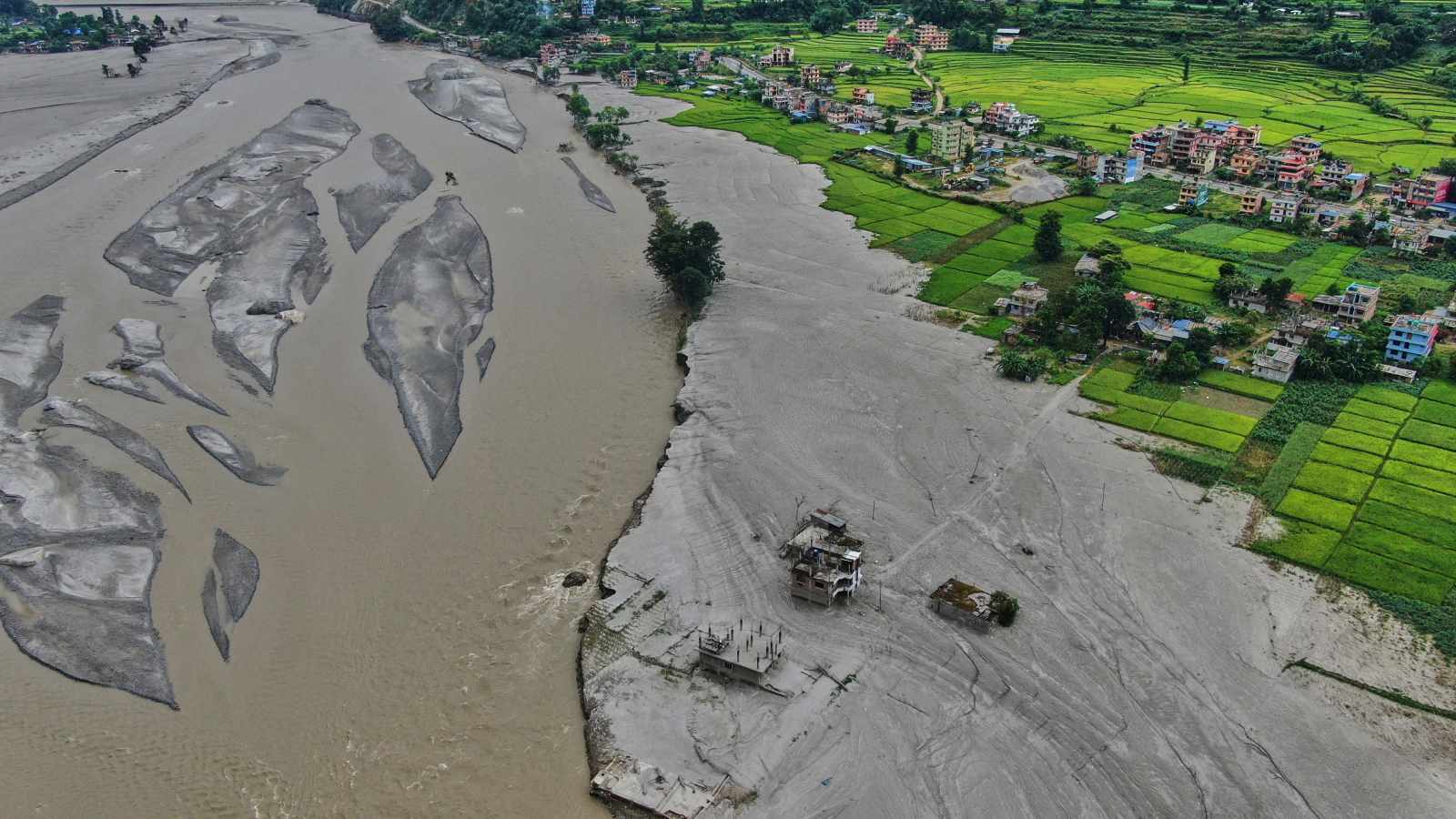
Disaster management in high-altitude topography is fundamentally an exercise in risk transference. When a catastrophic environmental shock like an avalanche occurs, the immediate media focus concentrates on the localized mortality rate and search-and-rescue logistics. However, the true systemic vulnerability lies in the sequential vulnerability cascade that follows. A month after a major avalanche event in the Himalayan corridor, the structural integrity of the affected watershed changes permanently. When subsequent monsoonal heavy rain arrives, it does not merely fall on normal terrain; it impacts destabilized slopes, altered river courses choked with glacial and avalanche debris, and communities whose coping mechanisms are already fully depreciated.
The Hydrological Multiplier Effect
The core hazard of post-avalanche monsoonal precipitation is the radical alteration of basin hydrology. An avalanche introduces millions of tons of snow, ice, rock, and earth into river valleys. This material forms temporary natural dams or raises the riverbed elevation through aggradation.
When heavy rain follows, three distinct hydraulic mechanisms amplify flood risk:
- Reduced Infiltration Capacity: Soil profiles compressed by massive snowloads or stripped of vegetative cover by previous scouring events exhibit near-zero infiltration. Precipitation immediately transitions into surface runoff.
- Debris Flow Genesis: Saturated avalanche debris mixed with intense rainfall transforms from sliding earth into high-density debris flows. These flows possess exponential destructive potential compared to clear-water floods, carrying boulders and ice blocks that act as battering rams against infrastructure.
- Channel Constriction: Accumulated ice and sediment choke narrow gorges, creating backwater effects that inundate upstream settlements long before the crest reaches downstream population centers.
Managing this risk requires shifting from reactive flood warnings to catchment-scale mass balance tracking. Traditional meteorological forecasts that measure only rainfall volume in millimeters fail entirely in these environments. A millimeter of rain on pristine forest yields a predictable discharge curve; a millimeter of rain on an unstable avalanche scar yields an unpredictable flash flood.
Institutional Friction and Resource Allocation
The transition from emergency rescue operations to long-term monsoonal flood preparedness exposes critical institutional bottlenecks. Emergency response agencies are optimized for speed and short-term survival metrics. Disaster mitigation, conversely, requires capital-intensive, multi-year engineering interventions and community relocations.
The friction manifests in three operational failures:
- Information Asymmetry: Meteorological data gathered at high altitudes rarely integrates in real-time with local hydrological gauge stations managed by separate ministries. This creates a blind spot during the critical window between upper-basin cloudbursts and lower-basin inundation.
- Logistical Atrophy: Once international media attention fades following the initial avalanche event, supply chains for emergency equipment, fuel, and medical provisions to remote mountain districts contract sharply.
- Community Fatigue: Populations subjected to recurrent shocks experience risk habituation. Having survived the avalanche, communities frequently discount the secondary threat of floods, misinterpreting the physical distance between the snow zone and their valley-floor settlements as a buffer.
The Economic Cost Function of Delayed Mitigation
In remote mountainous economies, the financial impact of compound disasters follows a non-linear trajectory. The primary cost is human capital loss, but the secondary cost is infrastructural isolation. When roads and bridges are washed out by monsoonal floods following an upstream avalanche, the economic recovery timeline stretches from months to years.
The cost function is driven by replacement latency. Because heavy transport infrastructure in high-relief terrain requires specialized engineering, every week that passes without temporary bridging locks in agricultural decay. Crops cannot reach markets, tourism revenue collapses due to perceived systemic danger, and the cost of basic food imports spikes due to broken supply chains.
Strategic Playbook for Watershed Resilience
Mitigating compound disasters in fragile mountain regions demands a strict operational hierarchy.
First, execute bathymetric and volumetric surveys of all river corridors impacted by avalanche debris within seventy-two hours of the initial event. Identify potential landslide dam locations before the monsoon season begins.
Second, deploy low-cost, telemetry-enabled water level sensors upstream of vulnerable settlements, linked directly to automated community siren systems. Do not rely on centralized cellular networks that fail during heavy rainstorms.
Third, enforce mandatory seasonal evacuation corridors along alluvial fans and debris-flow paths. Infrastructure hardening in these zones is economically irrational; spatial retreat is the only variable that reduces mortality to zero.