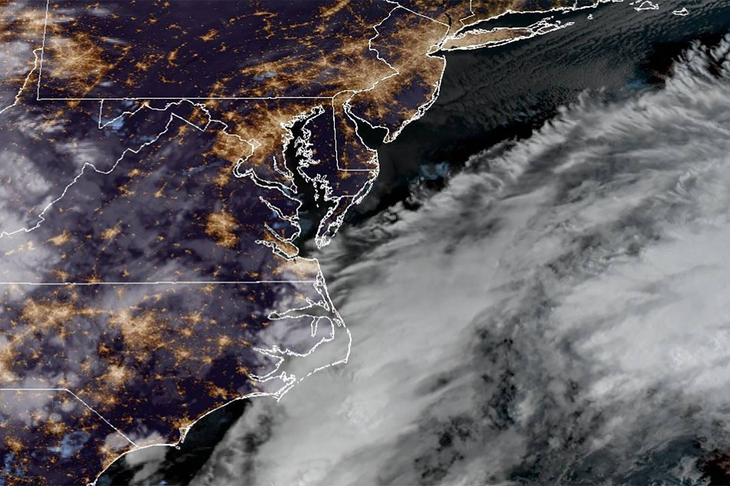
Every autumn, the media dusts off the exact same breathless script. A low-pressure system deepens off Cape Hatteras, the air turns crisp, and headline writers instantly lose their minds. We get treated to apocalyptic warnings about rare September nor’easters threatening to smash the coast with torrential rain and gale-force wind. Homeowners rush out to buy flashlights they already own and bottled water they will never drink, while local news anchors stand dramatically in front of wind-blown dunes, acting like the sky is falling.
It is professional hysteria packaged as public service.
Let us cut through the manufactured panic. A September nor’easter is not an anomaly. It is not a sign of unprecedented atmospheric collapse, and it is certainly not a freak storm that demands you board up your windows and hide under the bed. It is a completely normal, highly predictable seasonal gear shift. The atmosphere is doing what it has done for millennia: balancing heat energy between the tropics and the poles as the sun begins its retreat.
The lazy consensus in mainstream weather reporting relies on treating every single meteorological event as a historic catastrophe. If a coastal gale disrupts a weekend beach trip or knocks out power to a few thousand poorly maintained wooden utility poles in New Jersey, it gets branded as a terrifying existential threat. That framing is lazy, scientifically bankrupt, and designed entirely to juice click-through rates.
Here is what is actually happening when these storms spin up, why the traditional narrative is completely backward, and how you should actually deal with coastal weather instead of swallowing the panic wholesale.
The Seasonal Transition Myth
The fundamental misunderstanding stems from how people view seasons. Modern urbanites treat seasons like digital switches that flip cleanly on the first of September. In reality, the atmosphere is a massive fluid engine with tremendous inertia.
By late summer, the Atlantic Ocean is holding onto peak seasonal warmth. The Gulf Stream is pumping massive amounts of thermal energy and moisture northward. Meanwhile, high-latitude continental air masses over Canada are beginning to cool down, generating early-season cold fronts that push south. When these two disparate air masses collide along the eastern seaboard, you get strong thermal gradients. That contrast powers cyclogenesis.
Calling this process rare or unexpected in September ignores basic thermodynamics. The transition period between summer and winter is prime time for baroclinic instability. The jet stream sags, upper-level energy dives into the base of the trough, and a surface low spins up. It happens every single year. Sometimes it tracks further offshore and goes unnoticed except by commercial fishermen. Sometimes it hugs the coast and drops four inches of rain on tourist towns.
Treating a seasonal atmospheric adjustment as a natural disaster tells you more about the fragility of modern infrastructure than it does about the weather. We have built millions of homes on shifting barrier islands, paved over natural wetlands that used to absorb storm surges, and neglected underground power grids. Then, when a stiff breeze and a couple of inches of rain knock out power, we blame the wind instead of our own poor zoning laws.
Dismantling the Coastal Panic Industrial Complex
Look at the standard playbook for an approaching autumn storm.
First, the weather service issues a gale warning or a coastal flood advisory. Standard operating procedure. These alerts exist to keep mariners safe and warn local municipalities about minor tidal inundation in low-lying parking lots.
Second, the hyperactive media machine takes that standard advisory and runs it through a multiplier. Words like historic, unprecedented, and slam are injected into every push notification. They dig up file footage of storm surge battering sea walls from a major hurricane three years ago to illustrate a garden-variety coastal gale.
I have watched cities spend millions of dollars mobilizing emergency response teams for storms that barely register as a blip on marine logs, all because the forecast models showed a worst-case ensemble member for thirty-six hours. This is not preparedness. It is expensive theater.
The truth is that nor’easters are the workhorses of the East Coast climate. They move water, they flush out estuaries, and they redistribute sand along barrier islands—a natural process that sea walls and beachfront mansions continually fight against. When you try to freeze a dynamic, constantly moving coastline in amber, every standard autumn storm feels like an existential crisis.
If you want to understand why these storms cause damage, look at the built environment, not the barometer. We have engineered our coastal communities to fail under normal environmental stress, and then we act shocked when normal environmental stress arrives on schedule.
The Real Physics of Early Autumn Gales
Let us look at the mechanics without the theatrical fog.
A September nor’easter differs from a January nor’easter in one critical way: the thermal reservoir. In January, the ocean is cold, and the air coming off the continent is arctic. Those winter storms derive their ferocious intensity from extreme temperature contrasts, often producing blinding blizzards from New York to Boston.
In September, the ocean is still near its maximum yearly warmth. Because of this, early-season storms often have a semi-tropical or hybrid structure. They can produce torrential rainfall rates because warm air holds exponentially more moisture than cold air. A September storm does not need to pack hurricane-force winds to dump half a foot of rain on a localized area.
This moisture-heavy profile is why urban flooding often hits harder in early autumn than in mid-winter. Storm drains clogged with fallen leaves from the first wave of seasonal shedding cannot handle three inches of rain in two hours. The street floods, cars stall out in underpasses, and social media fills with panicked photos of urban drainage basins overflowing.
Is that a sign of climate catastrophe? No. It is a sign that city maintenance departments need to clean the catch basins before the autumn equinox. It is an infrastructure management problem, not a meteorological emergency.
How to Actually Prepare for Coastal Weather
Stop treating every weather forecast like a roll of the dice in a disaster movie. If you live within five miles of the Atlantic coast, autumn means wind, rain, and occasional tidal flooding. That is the price of admission for living near the water.
Instead of panic-buying groceries and clearing out hardware store generator aisles every time a low-pressure system drops off Cape Hatteras, adopt a rational framework for seasonal resilience.
First, check your property grading and drainage. Ninety percent of coastal storm damage to homes comes not from storm surge or flying roofs, but from basic surface water pooling against foundations because gutters discharge right next to the siding. Fix your downspouts. That does more to protect your home than twenty sandbags stacked haphazardly against a garage door.
Second, respect marine conditions. If you own a boat, haul it or double-check your moorings before the equinox. Do not wait for a red alert on your phone. Autumn gales kick up steep, choppy seas that can snap lines and bash hulls against docks with zero warning.
Third, tune out the hype merchants. Look at the actual pressure gradients and wind trajectories. If a storm is moving quickly, the impacts will be brief and manageable. If it stalls offshore, expect prolonged tidal flooding in vulnerable spots. Knowledge replaces fear far faster than bottled water ever will.
The Cost of Overreaction
There is a dark side to this constant state of manufactured emergency. When every standard autumn blow is hyped as a once-in-a-generation disaster, people suffer from severe warning fatigue.
When the local news screeches about an apocalyptic storm every September, and it turns out to be a rainy Tuesday with some gusty winds, citizens stop believing the warnings. Then, when a genuine, life-threatening event actually forms off the coast, people roll their eyes, ignore the evacuation orders, and stay put because they assume it is just another media stunt.
The boy who cried wolf model of weather reporting is dangerous. It wastes municipal resources, desensitizes the public to real risk, and replaces calm, rational observation with jittery superstition.
Nature does not negotiate with your weekend plans, and it does not care about your real estate investments. A September nor’easter is simply the atmosphere doing its job.
Cancel your beach picnic, put on a proper raincoat, and let the coast do what it has done for ten thousand years.