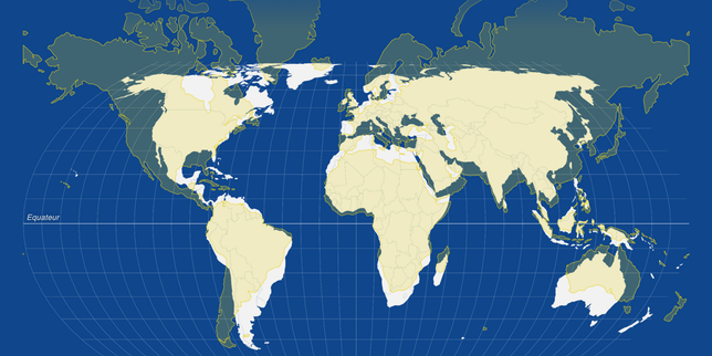
Most people think maps are boring geography lessons left over from middle school. They aren't. Inside the glass halls of the United Nations, a single line drawn on a piece of paper can trigger diplomatic expulsions, trade embargoes, or actual gunfire. Maps are political declarations disguised as science. When the UN publishes an official world map, governments panic, ambassadors storm out of assembly rooms, and foreign ministries draft emergency press releases. Why? Because the United Nations Cartographic Section wields an invisible power that few citizens ever realize exists. If you want to understand why global conflicts erupt over tiny patches of dirt, you have to look at how maps dictate reality on the international stage.
Why a Simple Line on a UN Map Can Start a War
Borders lie. Maps lie. Cartography is storytelling. You might also find this related story useful: The Shadow Heir And The Rubble Of Tehran.
The Cartographic Section of the United Nations isn't just a quiet office filled with old atlases and ink pens. It is ground zero for geopolitical friction. Established decades ago to provide standardized geographic data for peacekeeping operations, humanitarian aid, and General Assembly resolutions, this tiny department faces an impossible task. They have to draw borders that satisfy international law while avoiding diplomatic explosions. Every single boundary they depict carries immense legal weight. When the UN adopts an official map, it implicitly or explicitly validates territorial claims. Governments know this. That is why powerful states lobby aggressively behind closed doors to influence how boundaries are rendered in UN publications.
Consider the complex saga of Western Sahara, Kashmir, or the Abyei region between Sudan and South Sudan. On standard commercial maps, you might see solid lines, dashed lines, or shaded zones accompanied by explanatory disclaimers like "Boundaries not necessarily authoritative." Those disclaimers are diplomatic body armor. They protect the UN from taking a definitive stance while acknowledging that two or more member states claim the exact same territory. Yet, ambassadors from disputing countries obsess over those disclaimers. If a dashed line suddenly becomes a solid line on a UN-issued map, it makes national television news in the countries involved. Politicians wave the map in parliamentary debates as proof of international validation. Conversely, if a country's claimed territory is omitted or grayed out, protests flood the Secretary-General's office within hours. As reported in latest articles by The Washington Post, the results are widespread.
How the United Nations Cartographic Section Actually Works
The UN Cartographic Section follows strict guidelines, but those guidelines are constantly tested by political pressure. According to standard UN practice, maps produced by the Secretariat must reflect the official consensus of the General Assembly or the Security Council. But what happens when there is no consensus? What happens when a permanent member of the Security Council backs one side of a territorial dispute while the majority of the General Assembly backs the other? The cartographers are caught in the middle. They must rely on administrative directives, historical resolutions, and sometimes sheer diplomatic survival instincts to decide whether a territory gets a dotted border or a warning note.
You would think that modern satellite imagery and GPS technology would make border drawing an exact science. Satellites don't care about politics. They just show rivers, mountains, and coastlines. But sovereignty isn't about physical geography. It's about political recognition. A river shifts its course due to natural erosion, and suddenly a village that was once on the left bank is on the right bank. Does the international border move with the river? Treaties written a century ago might say yes, while the local population says no. When these disputes land on the desk of UN legal advisors, they realize that geography is deeply human and messy.
The Weight of Provisional Lines
Take the Blue Line between Lebanon and Israel as a prime example. Established by the UN in 2000 to confirm the withdrawal of Israeli forces from southern Lebanon, the Blue Line is explicitly noted as not being an international border. Yet, every single meter of that line is scrutinized by both sides. Blue helmets cannot patrol effectively if their navigation systems rely on disputed coordinates. A few centimeters off on a UN map can trigger military skirmishes. Cartographers working on these missions carry immense responsibility because their precision keeps armed forces apart.
The Real Stakes Behind Disputed Borders and Dashed Lines
There is also a psychological dimension to cartographic power that diplomats understand all too well. Visuals imprint on the human brain faster than text resolutions. When schoolchildren around the world look at a UN-produced map, they absorb a specific geopolitical worldview. If a disputed island chain is colored the same as the mainland, millions of people grow up accepting that ownership as an objective fact. Authoritarian regimes and democratic superpowers alike understand this cognitive bias. They invest massive resources into shaping international atlases and lobbying international organizations to adopt their cartographic standards. Losing the map war often means losing the diplomatic war long before any troops mobilize.
Running the mapping division at the UN requires nerves of steel and diplomat-level tact. The staff consists of geographers, GIS specialists, and cartographers who must navigate minefields of international law. When peacekeeping missions deploy to volatile zones like the Democratic Republic of the Congo or disputed borderlands across Eastern Europe and Asia, accurate maps are a matter of life and death.
Digital Databases and Instant Crises
Today, mapping has shifted from paper atlases to digital GIS databases and web portals. This transition has only raised the stakes. In the past, changing a map meant printing a new edition of an atlas, which took months or years. Today, a digital update on a UN portal can happen in seconds. This speed increases the pressure on cartographers. A rogue click or an accidental database update can spark an international incident before morning coffee. Member states maintain dedicated monitoring teams whose sole job is to scrub international databases for unauthorized boundary changes. When an error occurs, diplomatic cables burn up with urgent inquiries.
If you ever find yourself working in international relations or policy analysis, you quickly learn to read maps backwards. You don't look at where the lines are drawn; you look at the disclaimers attached to the margins. You look at the metadata. You ask who funded the survey data and which committee approved the final render. Transparency in cartography is rare because maps are instruments of statecraft. Recognizing this changes how you consume global news. You stop seeing maps as passive windows into the world and start seeing them as active battlegrounds where borders are fought over with lines of ink and pixels.

