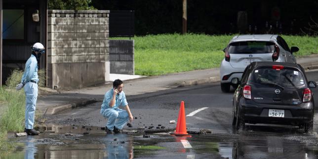
Geographic isolation dictates the operational failure modes of humanitarian logistics in eastern Indonesia. When tectonic displacement triggers high-magnitude seismic events on islands like Flores, the physical architecture of the region immediately transforms secondary infrastructure into critical failure points. Standard media reporting routinely attributes delayed relief efforts to generic institutional friction or unpredictable weather patterns. This superficial analysis obscures the underlying mechanical variables: port bathimetry, runway load limits, single-lane arterial road networks, and decentralized municipal stockpiling failures.
Understanding disaster response in this insular topography requires a shift away from qualitative descriptions of human suffering toward a rigorous examination of the logistical throughput capacity. Every intervention relies on a sequence of precise transfers from international cargo holds down to last-mile distribution nodes. When any single link in this chain exceeds its maximum threshold, the entire relief apparatus stalls, compounding the vulnerability of displaced populations.
The Structural Anatomy of Supply Chain Failure
The movement of heavy relief equipment—desalination units, mobile field hospitals, heavy earthmoving machinery—into an affected zone follows a rigid mathematical formula governed by weight limits and port handling speeds.
Total Delivery Time = T(Port Processing) + T(Maritime Transit) + T(Unloading Capacity) + T(Inland Transport)
In the context of Flores, each variable introduces severe friction.
Port Infrastructure Constraints
Most regional harbors lack deep-water berths capable of accommodating heavy roll-on/roll-off cargo vessels. Consequently, large ships must anchor offshore, relying on lighterage barges or manual offloading onto restricted pier space. This manual dependency reduces throughput efficiency by up to 70% compared to automated container terminals. Furthermore, storage yards adjacent to these ports are typically minimal, leading to immediate gridlock when pallets of non-perishable goods, medical supplies, and shelter materials arrive simultaneously without sorting protocols.
Arterial Road Vulnerability
The interior topography of Flores is dominated by volcanic mountain ranges, restricting transit to narrow coastal highways and a single trans-island spine. Seismic activity invariably induces landslides along these corridors. Because the road network features minimal redundancy—often lacking alternative parallel routes—a single slope failure cuts off entire districts. Road clearance operations must compete directly with outbound medical evacuations and inbound supply trucks for the same single-lane capacity, creating a high-stakes queuing problem that degrades average transit speeds to near zero.
The Capital Allocation and Municipal Reserve Deficit
Disaster resilience correlates directly with pre-positioned capital and decentralization of supplies. Municipal governments across the Lesser Sunda Islands operate under tight fiscal constraints that preclude maintaining robust warehouse inventories for low-frequency, high-impact events.
When a major earthquake strikes, local authorities experience a liquidity and resource vacuum lasting between 48 and 96 hours. During this critical window, local first responders rely entirely on whatever stock is physically present within municipal boundaries. Because fiscal incentives favor immediate infrastructure development over dormant disaster reserves, these stocks are typically insufficient for populations exceeding ten thousand individuals.
The financial burden thus shifts upward to national agencies based in Jakarta. This centralization introduces bureaucratic latency. Procurement requests must clear multiple authorization tiers, transforming what should be an automated, algorithmic re-supply chain into a manual approvals process. By the time central funds clear and material procurement begins, the golden period for acute search-and-rescue operations has expired, and the crisis transitions from trauma care to infectious disease mitigation.
Information Asymmetry and Triage Inefficiencies
Resource allocation in the immediate aftermath of an earthquake suffers from profound data distortion. Traditional reporting structures rely on local administrative units (villages and sub-districts) to assess structural damage and casualty counts and transmit these reports upward via cellular networks or satellite links.
Seismic events routinely sever power grids and telecommunication towers. This infrastructure collapse creates total information darkness across remote valleys. Central command centers receive fragmented, anecdotal reports from satellite phones or surviving witnesses. Without accurate, geolocated damage assessments, logisticians cannot optimize vehicle dispatch schedules.
- Type I Errors: Relief supplies are dispatched to accessible areas with functional communication lines while severely impacted, isolated valleys remain unserved.
- Type II Errors: High-value assets like heavy lift helicopters are deployed based on unverified severity estimates, leading to underutilized capacity on return legs.
This data vacuum forces incident commanders to operate on heuristics rather than real-time telemetry, resulting in massive misallocations of high-cost operational assets.
The Last-Mile Distribution Breakdown
Reaching the provincial capital or even a regional district hub represents only the midpoint of the supply chain. The final distribution tier—moving aid from a district warehouse to an isolated village cut off by bridge collapses—represents the most resource-intensive phase of the operation.
When vehicular access is impossible, logisticians must transition to multi-modal transport: off-road motorcycles, tactical infantry units on foot, and rotary-wing aircraft. Each transition multiplies the cost per kilogram of delivered goods and introduces new logistical bottlenecks.
Rotary-wing assets are particularly scarce during regional emergencies. Military and commercial helicopter fleets operating in Indonesia must cover vast archipelagic distances. Flight hours are strictly limited by mandatory maintenance intervals, and unpredictable tropical weather patterns frequently ground visual-flight-rules aircraft for hours at a time. Relying on air drops without ground security and crowd control mechanisms often leads to secondary distribution chaos, where supplies are damaged upon impact or unevenly seized by local factions, leaving the most vulnerable demographics unassisted.
Operationalizing Resilience
To eliminate chronic bottlenecks in future seismic events, disaster management strategy must abandon reactive emergency mobilization in favor of decentralized, hard-engineered redundancy.
Municipalities must establish regional prepositioned cache sites every fifty kilometers along major transit corridors, structurally hardened against lateral seismic loads and equipped with independent solar power and satellite uplinks. These caches must contain baseline medical kits, water purification hardware, and modular bridge components capable of restoring single-lane heavy vehicle traffic within twelve hours of a structural collapse.
Concurrently, maritime logistics require capital investment in shallow-draft landing craft utility vessels dedicated exclusively to island chains prone to tectonic instability. These vessels bypass the requirement for deep-water piers, discharging cargo directly onto unobstructed beaches.
Integrating automated IoT seismic sensors along critical highway cuts will eliminate reliance on manual damage reporting, transmitting immediate geospatial alerts to logistics command software to automate the rerouting of supply convoys before human analysts even process the event.
Deploy heavy mobile stock inventory directly to regional sub-district hubs with automated satellite dispatch triggers tied to moment magnitude scale thresholds rather than human administrative verification.