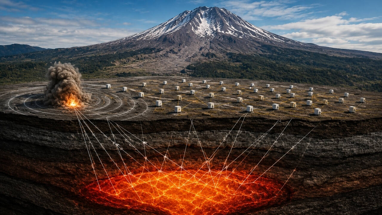
In the summer of 2014, a string of heavy seismic charges detonated across the Pacific Northwest, sending controlled shockwaves deep into the Earth around Mount St Helens. This wasn't a military test or routine mining operation. Geologists set off 23 targeted blasts to map the plumbing system of one of America's most active volcanoes, answering questions that standard surface observations could never resolve.
Seismometers stationed across the region recorded how these shockwaves traveled through different layers of rock and molten material. Because sound and seismic waves move at varying speeds depending on the density and temperature of the medium they cross, researchers could reconstruct a three-dimensional image of the subterranean architecture. The goal was simple yet urgent: figure out how magma moves, where it pools, and what triggers an eruption from a volcano that caught the nation off guard in 1980.
The Blind Spot Beneath the Cone
Most people picture a volcano as a simple, vertical pipe connecting a pool of lava straight to the surface. Reality is far messier. Decades of research showed that magma does not sit in a single, convenient reservoir waiting for an outlet. Instead, it accumulates in complex, distributed networks of storage zones spanning miles beneath the crust.
Before the 2014 experiment, known as the Imaging Magma Under St Helens project or IMUSH, scientists had only vague outlines of these deeper chambers. They could detect earthquakes caused by shifting rock, but those tremors only provided rough coordinates. They needed a high-resolution CAT scan of the volcano.
By placing over three thousand temporary seismic instruments across a vast grid, researchers created an acoustic camera sensitive enough to distinguish between solid granitic rock and partially molten mush miles underground. The logistics were staggering. Crews hauled heavy equipment on foot through dense wilderness, dropping explosive charges into boreholes packed with gravel and stemming material to maximize the downward force.
What the Shockwaves Revealed
When the data was finally processed, the results completely shifted our understanding of volcanic plumbing. The seismic imaging revealed that Mount St Helens is fed by a reservoir system originating much deeper in the crust than previously assumed, stretching down toward the boundary between the Earth's crust and mantle.
Crucially, the data showed that the active magma storage region is not located directly beneath the modern volcanic cone. It sits slightly offset, forcing magma to travel horizontally before rising through vertical pathways to the surface. This lateral migration explains why surface deformation and gas emissions can sometimes appear detached from the deep-seated processes driving them.
Another major finding involved the crystal content of the magma storage zones. Geologists discovered that the subterranean chambers are not vast pools of liquid fire. They are mostly composed of hot, spongy crystal mush with pockets of melt interspersed throughout. An eruption requires specific triggers, such as injection of fresh, hotter magma from below, to mobilize this viscous sludge and drive it upward.
The Mechanics of Controlled Explosions
Executing an acoustic survey of this scale requires precision engineering and regulatory navigation across national forests. Technicians drilled shot holes ranging from several dozen to over a hundred feet deep, placing explosive charges weighing hundreds of pounds at the bottom.
When detonated, these charges released energy equivalent to small earthquakes. As the seismic waves bounced off boundaries between different rock layers, they returned to the surface with encoded signatures of the interior density.
Analyzing these signals required massive computing power. Researchers used inversion algorithms to calculate the velocity models that best matched the recorded travel times of the seismic waves. Every rock type leaves a fingerprint on the wave. Basalt, granite, and molten rock all slow down or accelerate seismic energy differently, allowing geologists to map the transition zones where solid crust gives way to semi-liquid magma.
Why This Matters for Pacific Northwest Safety
Understanding the internal anatomy of Mount St Helens is not an academic exercise. The Cascade Range is a subduction zone where the Juan de Fuca plate slides beneath the North American plate, creating conditions ripe for explosive volcanism.
When Mount St Helens blew on May 18, 1980, it reduced the summit by over a thousand feet and unleashed a lateral blast that leveled forests across hundreds of square miles. That disaster proved that historical dormancy means nothing in the face of tectonic forces.
By mapping the modern magma network, researchers can better interpret pre-eruptive unrest. When swarms of small earthquakes strike the area today, seismologists cross-reference the hypocenters with the 2014 imaging data to determine whether magma is pressing against the crystal mush zones or if the tremors are merely tectonic adjustments in the surrounding crust.
Monitoring networks now leverage these insights to refine alert levels and evacuation models. While predicting the exact hour of an eruption remains impossible, knowing the geometry of the storage system provides an invaluable baseline for hazard mitigation.
The 23 blasts of 2014 transformed Mount St Helens from an unpredictable hazard into one of the most thoroughly imaged volcanic systems on the planet. The mountain still holds secrets in its deeper roots, but the days of guessing what lies beneath the crater are gone.